Location and access
How to get here
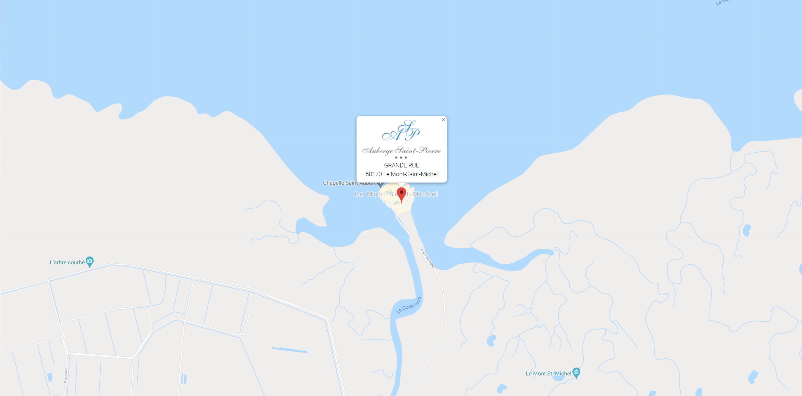
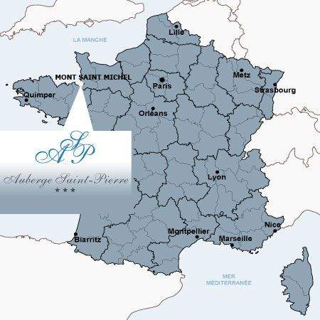
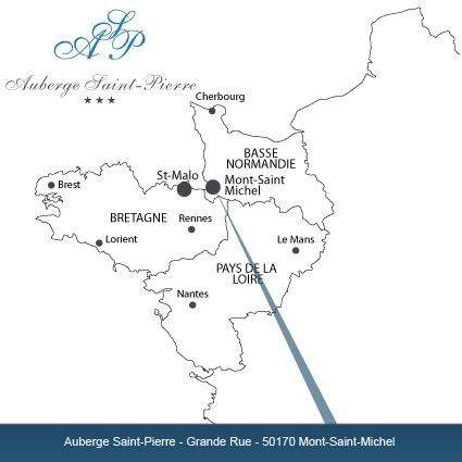
The Auberge Saint Pierre is on the Mont Saint Michel rock in the English Channel in Normandy.
By Car :
From Paris the A13 Normandy motorway
Rouen > Caen > Mont Saint Michel 355 km and 3h50
For further information : www.viamichelin.co.uk
GPS coordinates: Latitude: 48.6353532 Longitude: -1.5108987
By Train :
Pontorson 7 km 11 minutes
Dol de Bretagne Train Station 29 km 30 minutes
Rennes Train Station 82 km 1h10
For further information :
www.tgv-europe.com
PRATICAL INFORMATION FOR ACCESS AT MONT SAINT MICHEL:
The hotel located on the Mont Saint Michel site is not accessible by car.
We advise you to park your car at public car park P3 on the mainland. (paid parking -24 hour package).
To get there, follow the signs indicating MONT SAINT MICHEL- BUS / HANDICAPE then the signs HOTELS INTRA MUROS.
To enter in this car park you will need an access code that you can have 24 hours before your arrival, you can obtain it by calling us or by e-mail.
Shuttles bring you near the Mont Saint Michel, the departure is located next to the car park P1.
To truly enjoy the most of your stay, it is better to bring small luggage. The shuttle will drop you about 400 meters for the entrance to the village, we are located on the right hand side of the main street.
For all arrivals or departures between 22 pm and 8:30 am, you have to call this number: 0033.(0)2.14.13.20.11 to ask for a shuttle to bring you to the Mont.
Parking map and rates: www.ot-montsaintmichel.com
INFORMATION ABOUT ANIMALS AND THE SHUTTLE
Know that if you come with your pet, access will be complicated, pets are prohibited in the shuttle. To come to the village from the car park, it will be necessary to walk about 3km.
INFORMATION CONCERNING PARKING MANAGEMENT
We inform you that the car parks are managed by an EPIC. Our establishment is totally independent and cannot be held responsible. For all complaints concerning the car park, please contact directly 0033.(0)2.14.13.20.00. or by email toetablissement.public@montsaintmichel.gouv
Distances
| Distance (km) between Mont Saint Michel and: | |||
| Avranches | 24 | Dinard | 58 |
| Cancale | 41 | Rennes | 85 |
| Fougères | 45 | Laval | 102 |
| Dinan | 37 | Saint-Brieuc | 115 |
| Saint-Malo | 56 | Caen | 125 |
| Paris | 358 | Nantes | 196 |